
In the River TAKAHARA --Vol.86--
A Rock Shelf of Nagatou
One day in August, 1986, a year after I had caught the golden char in Kasadani, Mr. Shohei Katoh and I were driving along the River Takahara to Toyama Pref. The River Jintu, another name of the River Takahara, is one of the main rivers in Hokuriku district and has a lot of tributaries. Shimosadani (see Vol.5) flows into the right bank of the mainstream at the lower reaches of Kasadani and the famous tributary, Sugorokudani flows that way at the farther lower reaches.A little farther downstream, the River Atozu and across the border of Toyama Pref., the River Nagatou, my destination river this time, both tributaries also flows into the right banks of the mainstream. Every tributary above has a sluice gate at the upper reaches. Water taken from each sluice gate is sometimes discharged into the lower reaches and sometimes into the mainstream or other rivers. Water taken from Kasadani is discharged into Shimosadani, the next lower reaches of the river.

We started fishing from the upper reaches of the sluice gate. Piles of the giant rocks formed the dynamic scenery.
Water sharply decreases after being taken from the sluice gate. In the extreme cases, the lower reaches of the sluice gate looks like a tiny pool. Although some fish stay in such a tiny pool, I prefer to fish in rich water, that is, natural water. That is why I usually fish the creek at the upper reaches of the sluice gate.
In the River Nagatou the sluice gate was built farther upstream and the most part of the river had a very little water. If we start fishing from the lower reaches we will have to fish so long. As we also wanted to fish in the natural water level of the river we chose the route that directly led to the sluice gate, passing over the mountain.
A Flight of Stairs
We drove through Kamioka town, crossed the River Atozu and came near to Mozumi (see Vol.80). Then we turned right from the National Route and climbed the steep mountain road towards the Mozumi Pass. Passing the rocky ridge, we climbed down the road along the tributary of the River Nagatou.We had to get off the car before we reached the mainstream as the woodland path was closed to the traffic. Preparing for fishing, we walked down the woodland path to the sluice gate downstream.
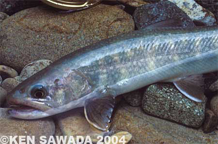
Fish staying at the lower reaches were a little greyish, reflecting the rock colour.
The valley was called the River Nagatou after joining with another tributary extended eastward. The tributaries flowed gently, whereas the mainstream formed a deep V-shaped valley. Black rocks soared almost vertically on the both banks of the valley. No sunshine seemed to reach there. As the woodland path was built along the edges of the precipice of the valley, we peeped into the river nervously with our heads down.
Walking on the half-dark woodland path, we suddenly found a block of flat white concrete. It was a flight of stairs to the sluice gate. Thank god, we don’t need to climb down the precipice! But at the bottom of my heart I felt strange to see the artificial concrete in the valley.
We walked down the bottom of the valley and found the mouth of the sluice gate covered with wire netting. Most water disappeared into the tunnel, while only a little flowed downstream.
It was nearly noon. We reached here rather late partly because the fishing course was not so long and partly because I thought that we would have had a fishing chance even if there had been earlier comers. Fortunately there was no other angler about.
In the stream of the source area there was enough water for August. I started fishing with black Speckled Sedge dressed on size 10 hook. Although the V-shaped valley bottom did not get much sunshine and the rock colour was dark, I could see size 10 fly clearly. Now I had only to wait for fish.

The barrier seemed to be built to protect the mouth of the sluice gate.
Soon after we started fishing upstream the barrier appeared ahead. When I put the fly on the stream in front of it, a char rushed to break the surface from below the bubbles. It attacked the fly with its mouth fully open.
A smallish char over 20cm stuffed its mouth with the fly. It hung at the end of the line. Black hackles sticking out of its mouth looked like whiskers. What a funny face!
There is a fish! Anglers worry about whether fish are staying even in the regular rivers. We feel uneasy in a new river until we actually see a fish. Probably most anglers who come to this valley plan to fish upstream from this sluice gate. Now I found the fish at the very spot here. We could expect to catch some fish at the upper reaches of the barrier. We were full of happy expectations.
Making a detour to the left, we reached at the upper reaches of the barrier. The scenery changed. Both banks still soared but the river bottom became flat and had brown stones. Probably the bottom was buried due to the construction of the woodland path. Although we could walk easily, we had to worry about fish density. Fortunately I saw a brisk char breaking the surface just at the upper reaches of the barrier.
The char was swimming on the surface slowly to the fly and swallowed it. It did not turn over immediately. Instead it tried to go down quietly in vain because I lifted the rod. It swam in the current so quietly like swimming in the still water.
Even after I hooked it, the fish did not know what happened with itself. I pulled it to the waterside. Then it first noticed what situation it was in and suddenly fought violently. It was the ideal situation for anglers. The fish had nothing but big appetite and lost cautiousness.

At the upper reaches the rock was brownish and fish had reddish colour.
When anglers fail in setting the hook to the fish that bit the fly, the fish that missed the tasty bait seem to feel more disappointed than anglers who missed the fish. If we cast the fly again it will attack the fly powerfully not so as to miss it.
When we passed over the barrier, that kind of fish bit the fly, one after another. Usually those fish appear mostly in June and July. I thought that it was the ideal fishing day in August.
A Jump
As the both banks became narrower, we could not walk off the waterside. We cast the fly in turn and caught char in turn. Fishing 500m upstream, we came to the gently meandering point of the valley. The space between the both rock walls was only 3m. There was full of water but no land called a bank.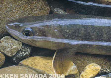
The size and shape of the fish I caught looked alike.
We walked along the left side of the bedrock behind the stream as far as the L-shaped spot. The stream became too strong for us to walk farther upstream. There was a foothold on the opposite bank, which would enable us to break through this bottleneck. But the strong stream would have washed us away if we had walked away from the bedrock only a little. For safety we climbed the cliff, making use of the foothold on the bedrock behind us. Then we jumped over the current towards the foothold on the opposite bank.
A lot of splash! Fortunately we jumped easily. To be honest, we could not have jumped over even a little higher water. I thought we would have to wait for fishing upstream until low-water season in August. To our delight, however, just after passing this bottleneck we enjoyed the most exciting fishing on the day. Although it was a short course, char broke the surface at the every point.
But soon the fish number suddenly decreased. I wondered why and found the answer. There was a woodland path nearby. Probably here came a lot of anglers who fished downstream in this rich-water season, starting from the farther upper reaches.
-- To be continued --
- NET SHOP INFORMATION

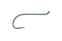
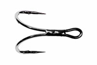
SL6 Black Spey Hooks
DU3 Limerick Spinner Hooks
SL4 Single Bartleet Hooks
XD1 Tube Fly Double Hooks

DD2 Flat Perfect Hooks
DD1 Black Terrestrial Hooks
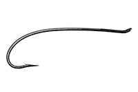
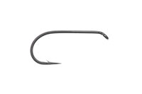
TD4 Old Limerick Wet Hooks

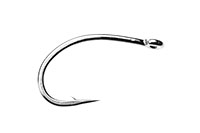
DU1 Silver May Hooks

MU1 Flat Midge Hooks

LD3 Long Limerick Hooks

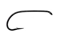
TD2 Summer Sproat Hooks
XS1 Tube Single Silver Hooks

TD6 Siver Sedge Hooks
SL5 Black Spey Hooks
DU3 Limerick Spinner Hooks
- TROPHY CLUB
- FLY SHOW
- EXHIBITION
- MASTERS`
- FLY DRESSING CONTEST Archives
- TRAVELLER Archives
- TACKLE IMPRESSIONS Archives
- ANGLERS` PHOTO GALLERY Archives
- ----------------------------------------------
- トロフィークラブ
- フライショー
- エキシビション
- マスターズ
- フライドレッシング・コンテスト・アーカイヴ
- トラヴェラー・アーカイヴ
- タックル・インプレッション・アーカイヴ
- アングラーズ・フォトギャラリー・アーカイヴ
株式会社サワダ 185-0021 東京都国分寺市南町3-13-4
SAWADA'S INC. 3-13-4 Minamicho, Kokubunji, Tokyo 185-0021, Japan
写真・ドキュメントの無断転載を禁じます。
All the images and documents found on this site are owned by Ken Sawada and may not be used without permission.
But, link to this site is FREE.
Copyright © 2000 - 2026 SAWADA'S INC.. All rights reserved.
SAWADA'S INC. 3-13-4 Minamicho, Kokubunji, Tokyo 185-0021, Japan
写真・ドキュメントの無断転載を禁じます。
All the images and documents found on this site are owned by Ken Sawada and may not be used without permission.
But, link to this site is FREE.
Copyright © 2000 - 2026 SAWADA'S INC.. All rights reserved.